In our previous post, we’ve covered the Texas County Map and in this post we’re covering the Ohio County Map. If you are interested to know more about the counties in Ohio and download Ohio map showing counties then this is the correct page to be at. Ohio is one of the states in the United States. Renowned for it’s rich history, geography, and cultural diversity.
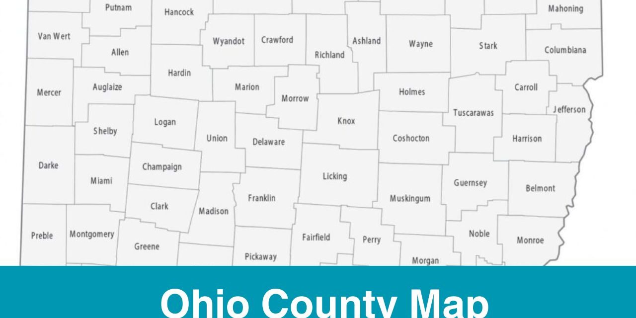
The state of Ohio is divided into 88 counties. The purpose of creating different counties is to make a well structured system where each county has its own local governance and organization. Ohio County Map is a valuable tool for those who are living or working in Ohio and those who are planning to visit Ohio either for vacation or business purposes.
Brief Information about Ohio Counties
Ohio is a state in the United States that is located in the Midwestern region of the country. In Ohio, there are 88 counties. The county system is implemented in each state of the country in order to have a well structed local governance in place which takes care of local matters, including education, infrastructure, etc. Ohio is quite diverse, you can find different ciulture here.
- Ashtabula County is the largest county in Ohio in terms of Area and it’s located in the northeastern Ohio.
- The smallest county in terms of Area is Lake County.
- When it comes to population, Franklin County is the most populous one.
- Vinton County is the least populous county in Ohio.
Printable Map of Ohio Counties with Cities
Here is a printable map of Ohio Counties. A printable map is one of the most valuable tools when it comes to studying geography of a particular state or region. This map can be used for educational, research, travel purposes, etc. Through a map, you get to explore the geography of different counties which offer endless opportunities for discovery.
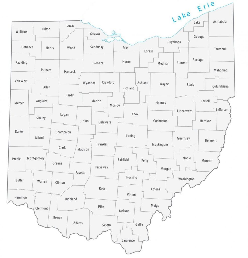
Map Source: https://gisgeography.com/
More U.S, County Maps
What are the major Cities in Ohio and their County?
Following are some of the major cities in Ohio:
Columbus
Let’s Begin with Columbus which is located in Franklin County. It’s one of the most famous cities in Ohio. It’s the state capital and the largest city in Ohio. In Columbus, there are many popular universities, academic opportunities, and research institution.
Cleveland
Cleveland is located in the Cuyahoga County of Ohio. This city is a major center of trade due to its position. Apart from the trade centre, Cleveland is known for it’s arts, culture, and industry as well. If you are visiting Cleveland as a tourist then do check out Rock and Roll Hall of Fame, Cleveland Museum of Art.
Cincinnati
Cincinnati is a city in Ohio, it’s located in the Hamilton County. It’s the third most populous city in Ohio. There are a lot of attractions in Cincinnati which attracts tourist all over the world. The famous attraction includes, Cincinnati Zoo, Over-the-Rhine district, and Great American Ball Park, etc.
Akron
Akron is located in the Summit County of Ohio. Akron is known in the world for it’s contribution to industry and innovation. It was also known as the “Rubber Capital of the World”. The tire and rubber industry revolution has started through this city. Many industries in the U.S. were influenced by the city.
Use Ohio County Map for Study, Travel, Research Purposes
A printable map is one of the most versatile tool, it’s hold importance for a diverse range of people be it a student, tourist, businesses, re-searchers, etc. Different people have different purpose of using a map which itself shows how versatile a map is.
Here we’re covering the map of Ohio Counties, using this map you get to know the geography and boundaries of each county in Ohio. The use of map is not limited to border and boundaries only, it;s a gateway to study about the state’s rich history, dynamic cities, and scenic landscapes.
Get to Know About Rivers in Ohio
Rivers play a huge role in the geography of each state. Rivers are a source of water for human beings, agriculture, and water sports activities. Following are some of the major river in Ohio:
- Ohio River
- Cuyahoga River
- Scioto River
- Maumee River
- Muskingum River
Use County Map for Travel Purposes
Ohio county map comes in handy when it comes to travel through different counties in Ohio. Make sure to have a copy of county map if you are exploring the Ohio state.
- For travel purposes, you may use Ohio road map
- Use a map to find famous attraction, locate parks, cultural attractions, etc.
Ohio is one of the diverse state in the United States where you can see everything from a rural areas to urban areas. You can find counties like Athens, Meigs, which are known for hills, forests, etc and you can find counties like Darke and Mercer which are known for rich agricultural lands. There is so much to explore in Ohio and a printable Ohio county map is your friend in this journey!

