
Check out the rivers of Europe map to know about the physical geography of European rivers. The European rivers map is best when it comes to learn about the rivers, check out the different maps here and download one for your use. Europe is a continent located entirely in the Northern Hemisphere and mostly in the Eastern Hemisphere. Just like any other continent, Europe has its great physical size and the weight of its history and traditions. Nothing works better than a map when it comes to study the physical geography of a continent.
Through this post, we will be studying the geography of European rivers with the help of blank and printable maps. Europe, the second-smallest continent in the globe after Australia, is home to one of the world’s most developed economies. Russia is the largest nation in the continent, accounting for the majority of both the population and the continent’s land area. 10% of the world’s population and almost 3% of the earth’s surface are occupied by Europe.
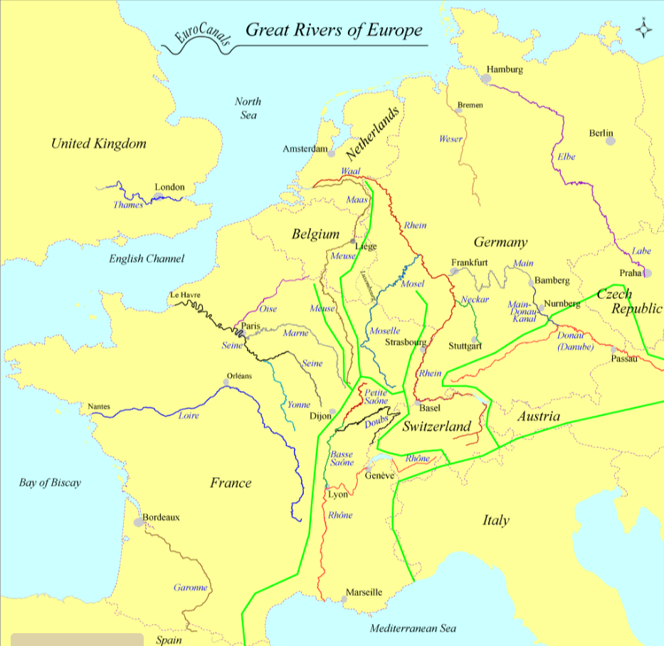
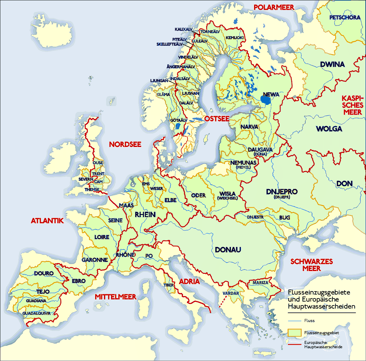
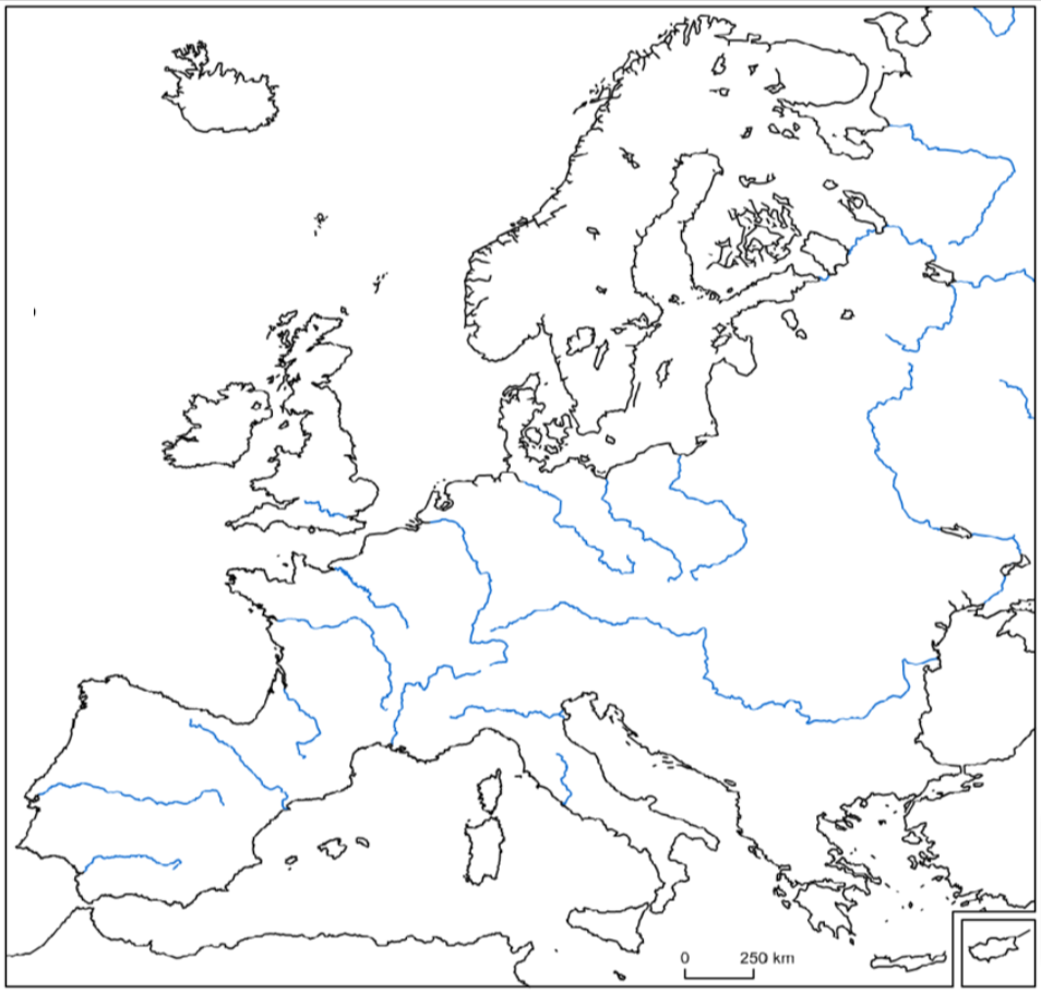
Rivers of Europe Map
Rivers should not be confused with seas, ocean, or lakes. Rivers are Flowing bodies of freshwater that empty into seas, oceans, lakes, and reservoirs. Over the years, Rivers are used as a source for drinking water, irrigation, transportation, and hydroelectric power generation, as well as for a variety of leisure activities like swimming and boating. Just like any other continent, there are rivers in the European continent as well. Below you can see a list of Major Rivers in the Europe.
- Danube River
- Dnieper River
- Tagus River
- Volga River
- Don River
- Elbe River
- Po River
- Rhine River
- Loire River
- Oder River
- Rhône River
- River Shannon
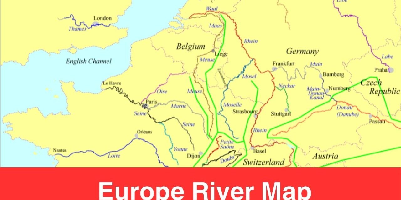
Map of Europe Rivers
Here you can find the dedicated map of European rivers that focuses upon all the rivers of Europe. If you are looking to study about the European Rivers then check out the European rivers map here. This map is kind of a physical geographical map of Europe that deals in the geography of rivers. Use this map to track down the physical geography of the major rivers of Europe.
Studying Europe rivers map could be a challenging task if you are a beginner in reading such maps. As you can see in the maps, there is the origin and the extinction point of all European rivers. You can also see through which regions the river is travelling across the whole continent. Nothing works better than a map of Europe with rivers when it comes to studying the physical geography of rivers.
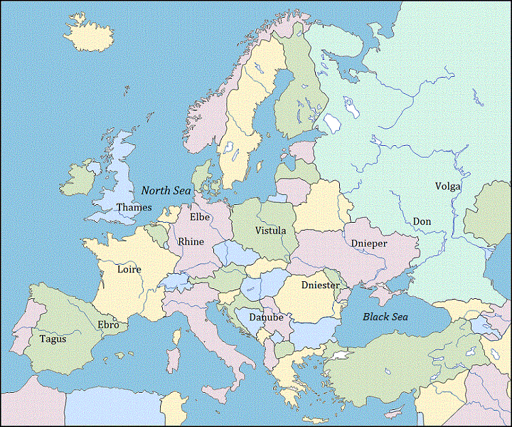
Map of European Rivers
The river map of Europe is available in a fully printable format on this page, take a print-out of any of the map from here. The templates can be used by our visitors and readers just like a full-fledged river map of Europe. To study the rivers of Europe, they simply need to print the template and bring it with them.
Europe Map Rivers and Mountains
Check out the Map of European Rivers and Mountains below to know about the rivers and mountains geography of the European continent.
Blank Map of Europe with Rivers
You can find the maps here in both printable and digital format. To take a print-out of the map, you need to first download it from here. As fas as digital format is concerned, you can get the map in PDF here.
Use any of the printable template here to begin your journey of understand the rivers of Europe or enhance your knowledge of the European rivers. Print any map of your choice and start the learning process.