
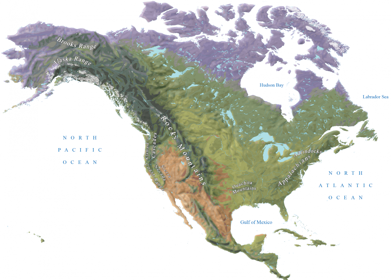
Here you can find out Map of Mountain Ranges in North America and download them for your use in a pdf format. If you are here searching for the Mountain Ranges in North America Map then simply download the printable map from this page and explore the geography of the Mountains in North America. These type of maps are used by students, geographers, mountaineers, trekkers, etc. Download any of the mountain map from this page and print it off for your use.
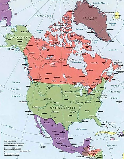
North America is a continent in the Northern Hemisphere and almost entirely within the Western Hemisphere. It is bordered to the north by the Arctic Ocean, to the east by the Atlantic Ocean, to the southeast by South America and the Caribbean Sea, and to the west and south by the Pacific Ocean.
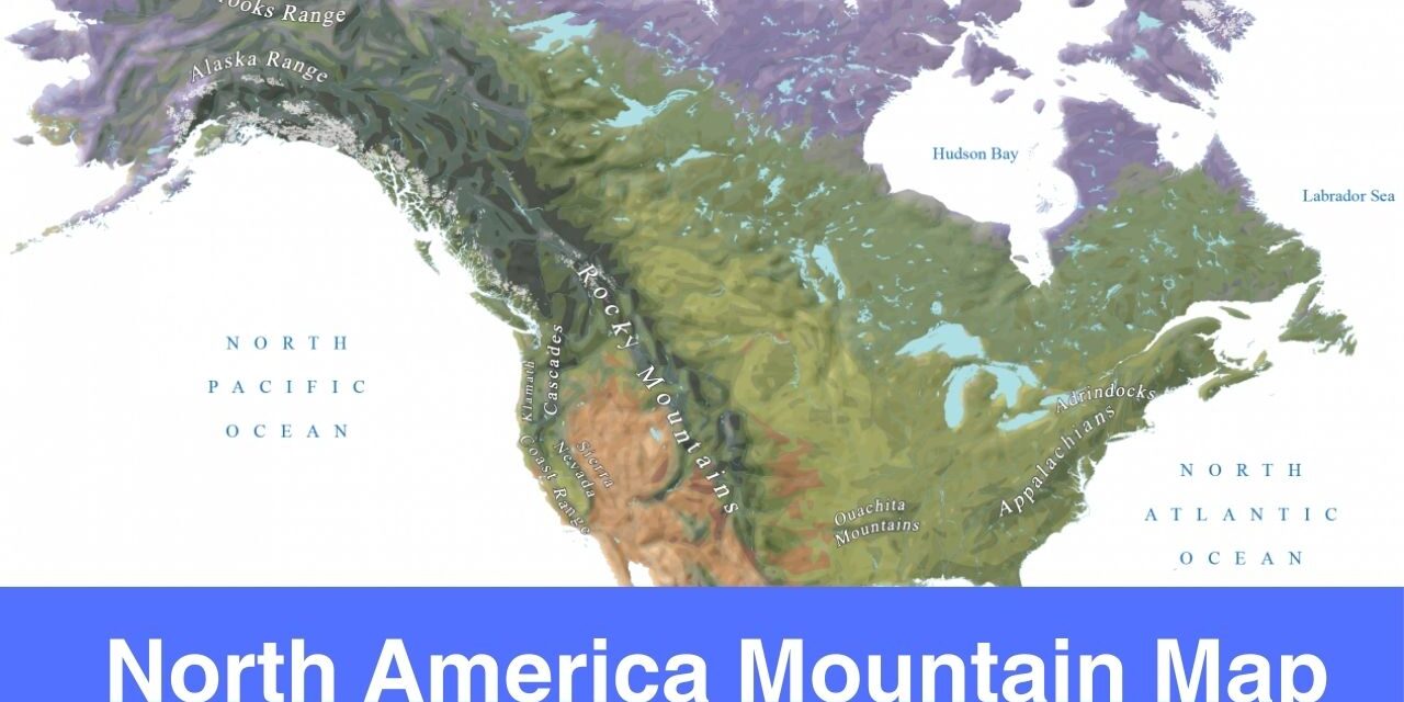
Mountain Ranges in North America Map
Studying the geography of a continent is incomplete without studying the mountains, rivers, and lakes. With the help of maps shared here, you can get to know the names of major mountains in North America and see important details as well.
Top 10 Mountain Ranges in North Americ
| Range | Highest Point |
| Alaska Range | Denali (6,200m) |
| Appalachian Mountains (incl. Blue Ridge, Cumberland, Catskills, Green and White Mountains) | Mount Mitchell (2,037m) |
| Canadian Rockies | Mount Robson (3,954m) |
| Cascade Range | Mount Rainier (4,392m) |
| Great Smoky Mountains | Clingmans Dome (2,052m) |
| Olympic Mountains | Mount Olympus (2,432m) |
| Rocky Mountains | Mount Elbert (4,401m) |
| Sierra Madre (incl. Sierra Madre Occidental and Sierra Madre Oriental) | Cerro Potosi (3,700m) |
| Sierra Nevada | Mount Whitney (4,421m) |
| White Mountains | Mount Washington (1,917m) |
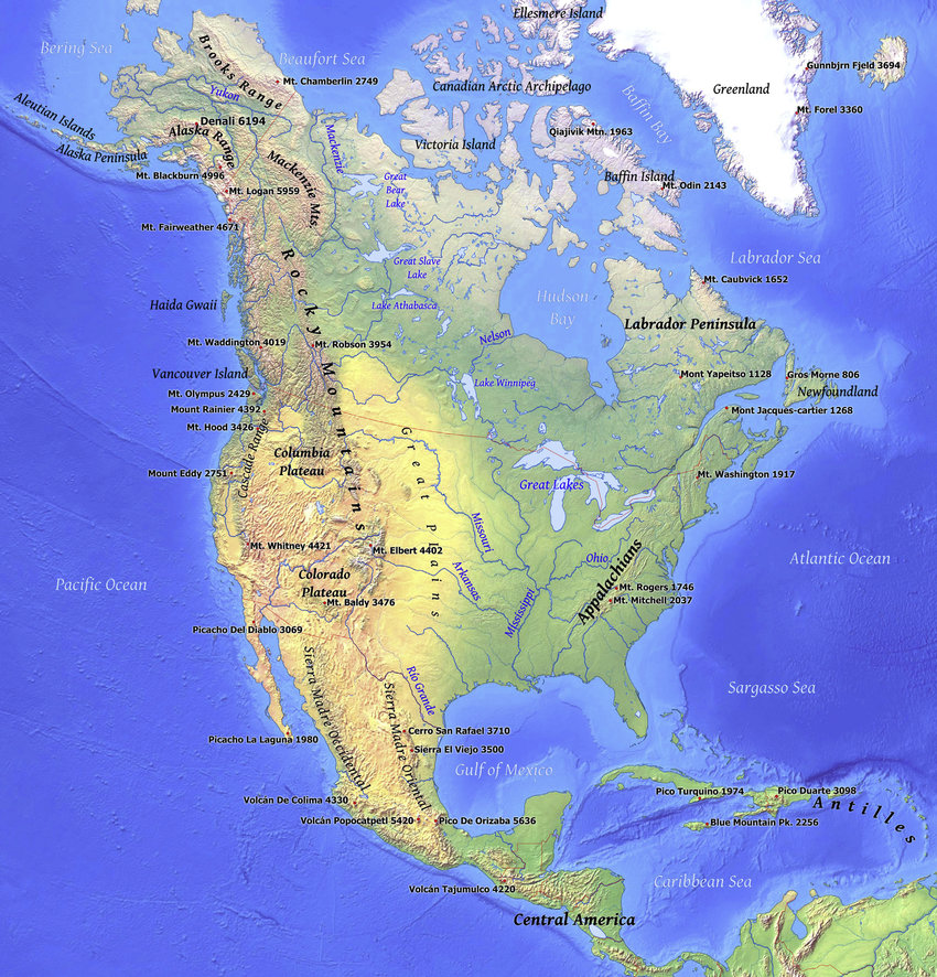
Mountain Range Map North America
North America is home to the highly developed countries and major cities of the world. Some of the highly developed cities are New York City, Los Angeles, Toronto, Mexico City. In order to understand the physical geography of a continent, you need a physical map of that continent. Here you can find out the printable North America Mountain map that will help the users in learning more about the mountains of the North America.
Mountain Ranges North America Map
Just like any other continent, there are mountains in North America as well. People often go on mountains or hilly areas for vacation or outing. Not only that, there are people who loves to hike and trek as well. Therefore, it is essential to have a mountain map in order to understand the geography of the mountain. Through this post, we are covering the Map of Mountain Ranges in North America. Feel free to download any of the map from here and print it off for your own use.
With the help of printable maps shared here, users can explore the geography of the North America mountains with ease. There are multiple mountain ranges in North America, this is why you must have a printable map with you in order to study them or explore the geography in a best way possible.
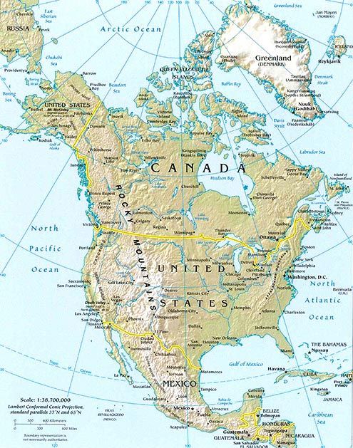
North America Map of Mountains
We have covered the printable maps of Mountains in North America. If you are interested in studying the geography of North America mountains then do download the printable maps from this page and print them for your use. North America is one of the seven continents of the world.
As you can see multiple templates are shared here. You can choose to download any map template from here and use it. There are tons of printable maps available in this site for free download. Explore the new maps here and enhance your geography knowledge to a whole new level.