
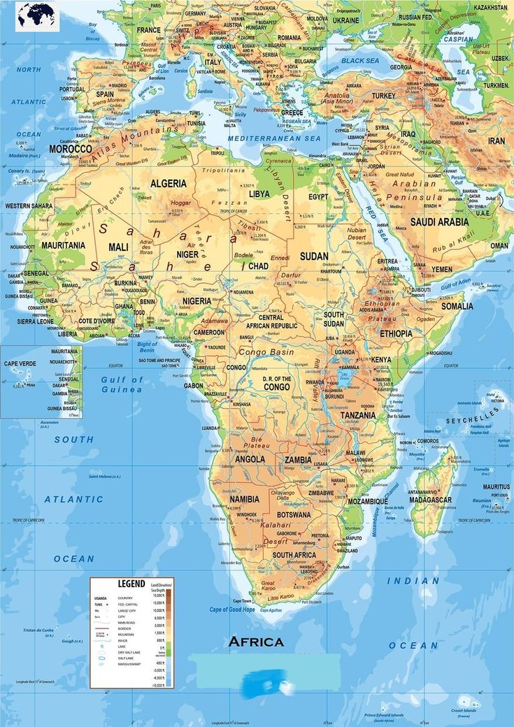
A labeled map of Africa is shared here for all those who are looking for it. Download map of Africa labeled from this page to obtain information about the African countries. People often see labeled map for historical research and learning purposes. If you are a geography student or enthusiast then do check out the labeled map here, download it, and take a print-out for your use. There could be many purposes of using a labeled map such as analysis, survey, learning, research, etc. Finding a good and clear map is a task, but no worries because we have gathered the best map of Africa labeled countries here for all our users.
Different type of maps are shared here such as labeled map of Africa countries, labeled map of Africa capitals, etc. Each map has some important information to convey, therefore, choose your map carefully depending on the type of work you are in. Take a print-out of the map after downloading it from here.
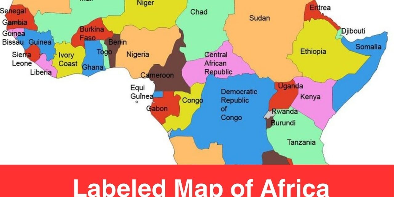
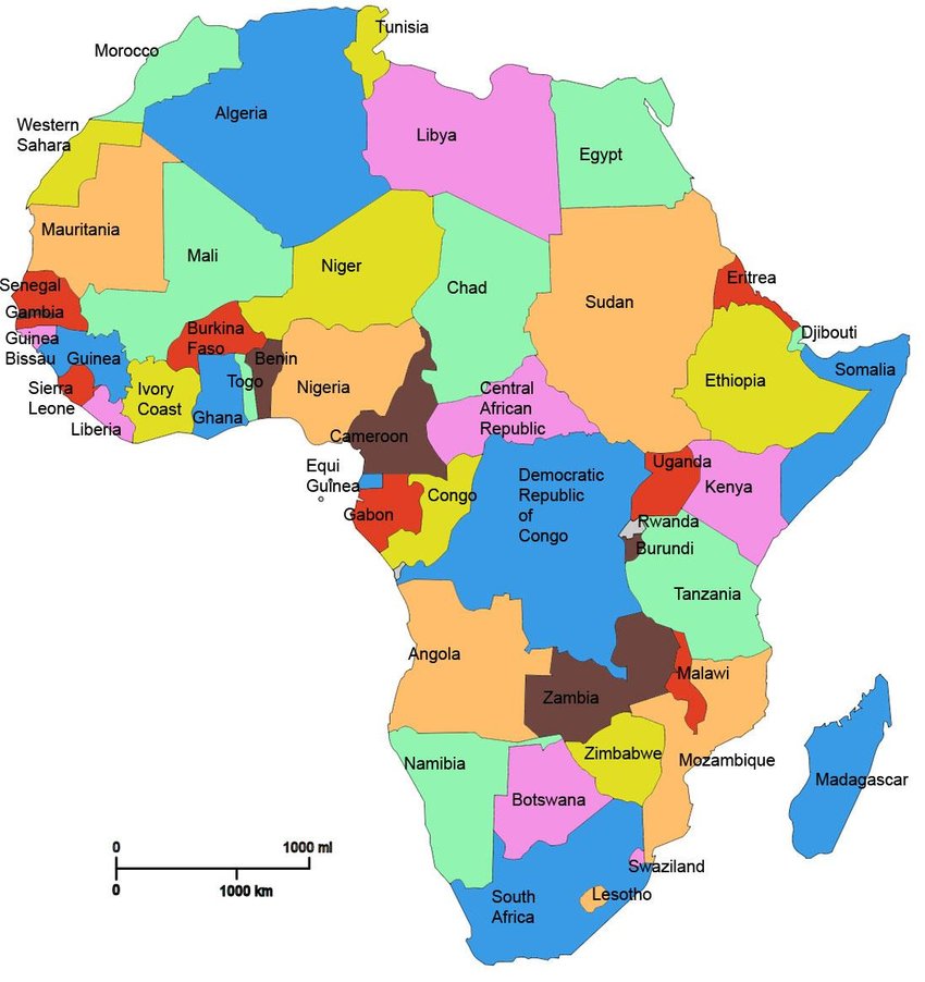
Labeled Map of Africa
Africa continent is a vast continent and there are a lot of things to learn from it. For a geography student or enthusiast there are always new opportunities to explore when it comes to studying any map. If you are looking to explore the geography of Africa continent then here we have map for you. A map of Africa reflects a variety of labelling details to study. Here, labelling the map means that it is possible to label rivers, countries, cities, states, and several other features.
Map of Africa with Countries Labeled
Please note that there are 54 fully recognized sovereign states (countries), eight territories, and two de facto independent states with limited or no recognition. If you talk about the largest country by area in Africa then it’s Algeria. The name of all the countries are mentioned in the map below and in the table (available at the end of this post). Just for your ease, please note that the map of Africa with countries is divided into countries, like North or Northern Africa, West Africa, Central or Middle Africa, East Africa, and Southern Africa.
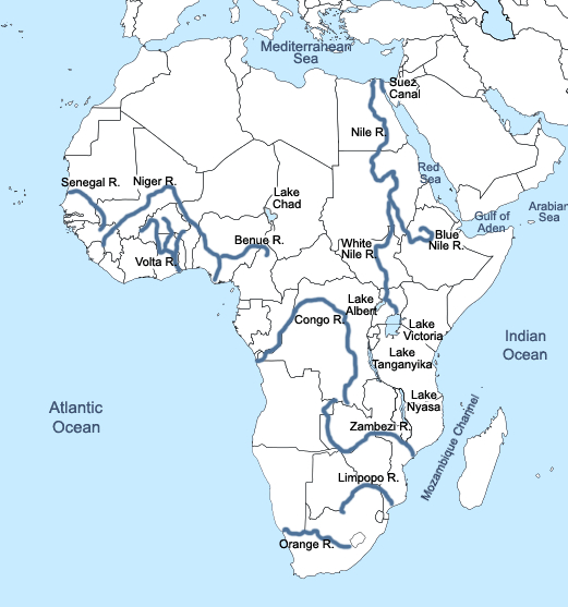
Labeled Map of Africa with Rivers
Check out the following map if you are interested in learning about the rivers in Africa. Please note that the longest river of the Africa is the Nile River. As per the info available, the length of Nile river is around 6,695 kilometers and is considered the longest river on the globe. The Nile River flows from south to north through eastern Africa. Water is a necessaity of life and Nile River is the central feature of life northeast Africa for thousands of years.
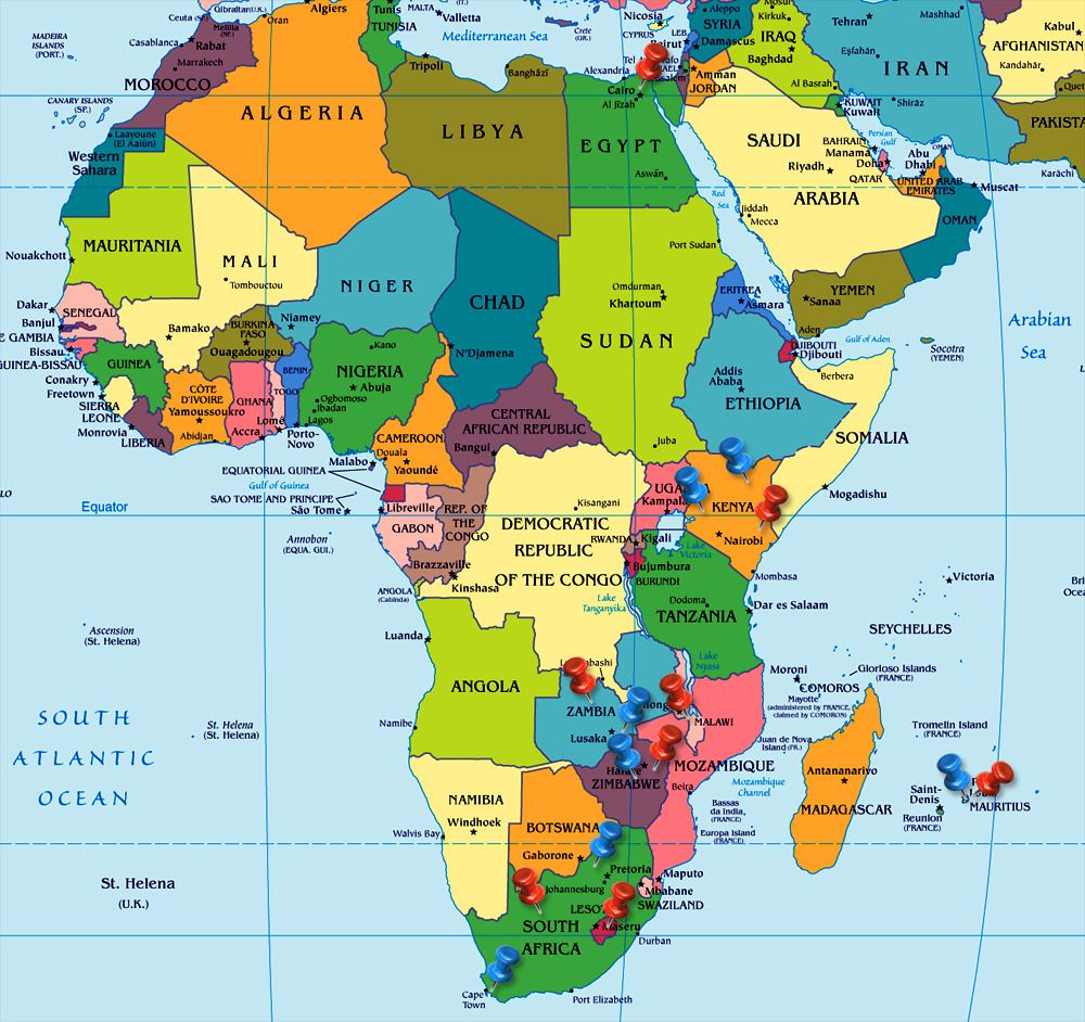
Labeled Map of Africa with Capitals
There are more than 54 capitals in Africa even though there are 54 independent nations. Check out the map below to know about the capitals of Africa continent.
Africa Map with Country Names
| Algeria | Central African Republic | Eritrea | Kenya | Mauritius | Senegal | Tanzania | |
| Angola | Chad | Ethiopia | Lesotho | Morocco | Seychelles | Togo | |
| Benin | Camoros | Gabon | Liberia | Mozambique | Sierra Leone | Tunisia | |
| Botswana | Democratic Republic of the Congo | Gambia | Libya | Namibia | Somalia | Uganda | |
| Burkina Faso | Republic of the Congo | Ghana | Madagascar | Niger | South Africa | Zambia | |
| Burundi | Djibouti | Guinea | Malawi | Nigeria | South Sudan | Zimbabwe | |
| Cameroon | Egypt | Guinea-Bissau | Mali | Rwanda | Sudan | ||
| Cape Verde | Equatorial Guinea | Ivory Coast | Mauritania | Sao Tome and Principe | Swaziland |