
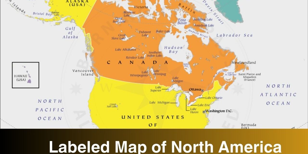
Labeled map of north America is shared here for download in pdf format. If you are here in search of the labeled map of north America then check out the map templates below. You can download and print the labeled map from this page, we have shared the map templates in PDF format in this page. Map labels are text postioned on a map in relation to map features, which collectively reflect real-world characteristics and attributes. The purpose of using a labeled map is to study the geography of a continent, country, state, city, etc.
Here we’re covering the map of North America labeled. North America is a continent in the Northern Hemisphere and almost entirely within the Western Hemisphere. If you are interested in the map of North America then check out the templates below.
Map of North America Labeled
There are plenty of labeled maps available on this page, you can access any of the map for your use. There is a lot to study when it comes to the geography of this continent. North America is the third largest continent by area in the world after Asia and Africa. North America ranks 4 in terms of population after Asia, Africa, and Europe.
On this page, you can find out the map of North America with labels. Download and print any of the map that you find the most useful. As you can see, the maps here are labeled with countries, cities, rivers, mountains, etc. A labeled map is great for learning and practice purposes as well.
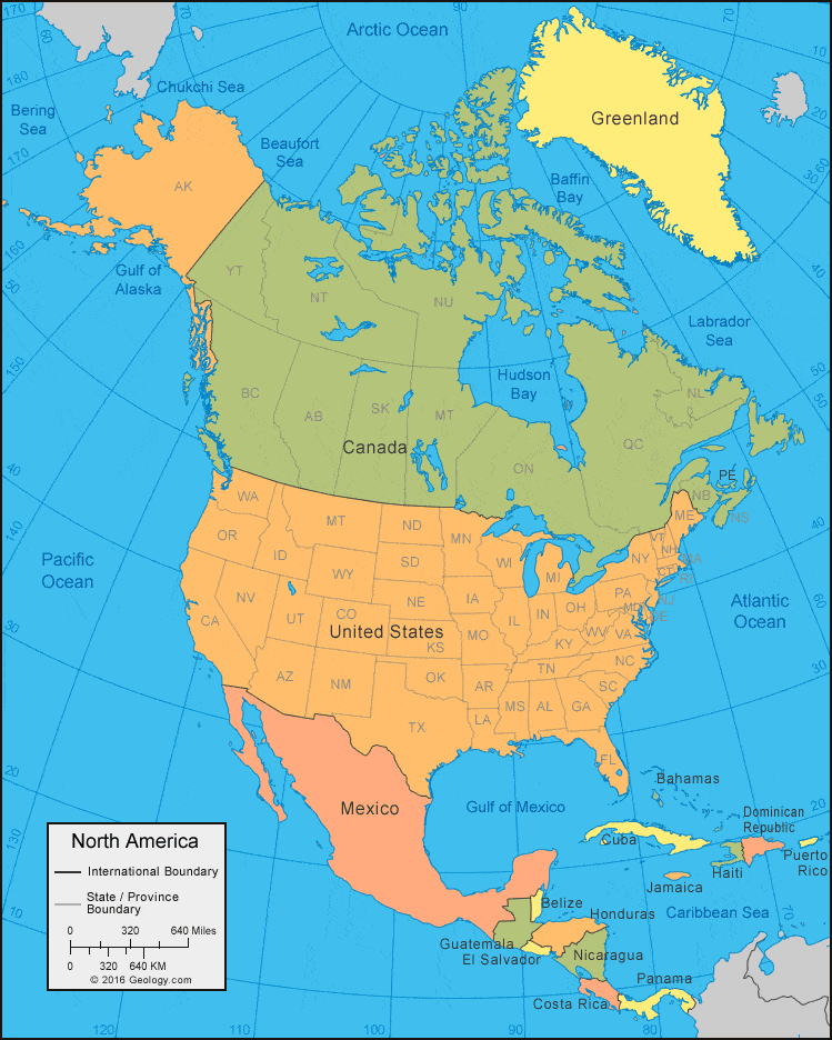
Labeled Map of North America with Countries
Below you can see a map of North America labeled with countries. Check out the map below to know the names of north America’s countries. North America is home to some of the highly developed countries in the world such as United States, Canada, etc.
There are 23 countries in the North American continent.
- Antigua and Barbuda (Caribbean)
- Bahamas (Caribbean)
- Barbados (Caribbean)
- Belize (Central America)
- Canada
- Costa Rica (Central America)
- Cuba (Caribbean)
- Dominican Republic (Caribbean)
- El Salvador (Central America)
- Grenada (Caribbean)
- Guatemala (Central America)
- Haiti (Caribbean)
- Honduras (Central America)
- Jamaica (Caribbean)
- Mexico
- Nicaragua (Central America)
- Saint Kitts and Nevis (Caribbean)
- Panama (Central America)
- Saint Lucia (Caribbean)
- Saint Vincent and the Grenadines (Caribbean)
- Trinidad and Tobago (Caribbean)
- United States of America
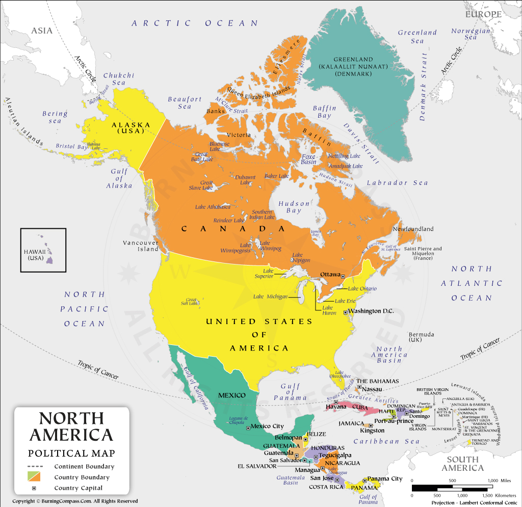
Labeled Physical Map of North America Capitals
Every country has its own capital. Check out the map below that is labeled with the capitals of north America’s countries. If you are wondering what is a capital then please note that it is the city or town that functions as the seat of government and administrative centre of a country or region.
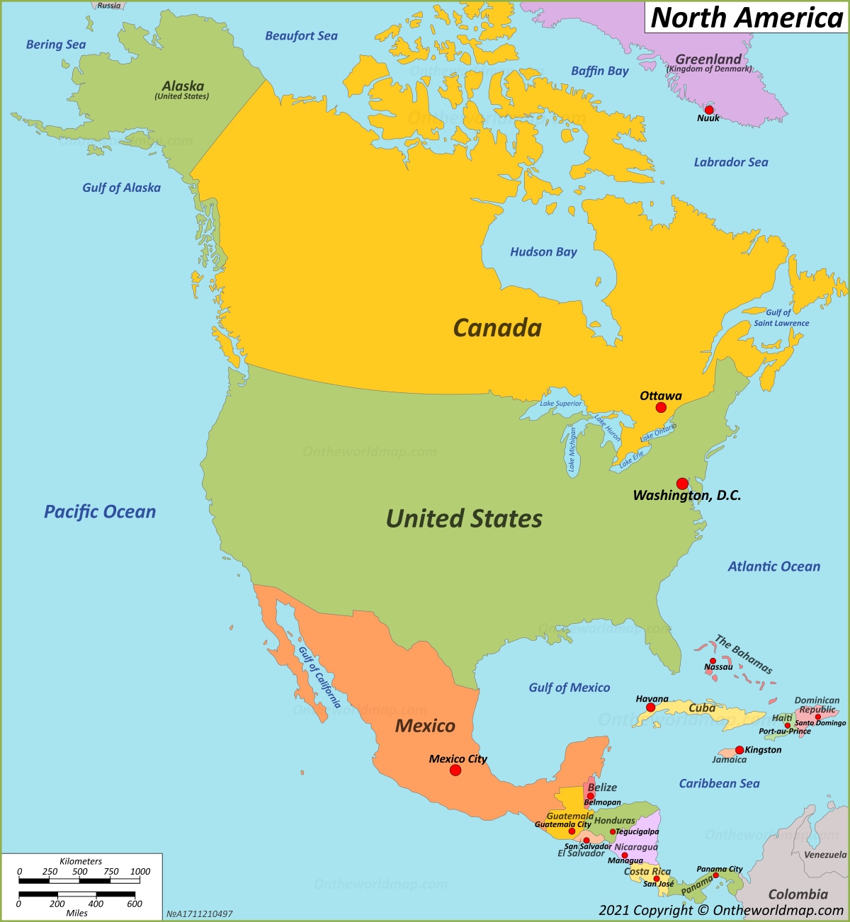
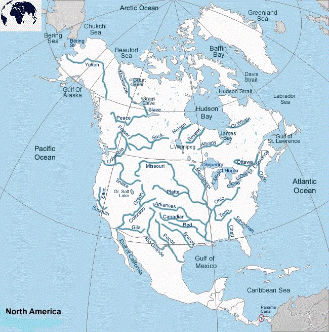
Labeled Map of North America Rivers
Do you want to know about the rivers in North America? If yes then check out the labeled map with rivers below. A labeled map is great for learning purposes, below you can see a map that is labeled with rivers in north America.
Now you have different labeled map of North America. You can download and print any of the map template from here. For more useful labeled and other type of maps, you need to keep checking this site.