
North Carolina is a state in the United States, located in the southeastern region of the nation. North Carolina has a very rich history, vibrant culture, and diverse landscapes. In this page, we have shared the North Carolina County Map templates in a printable format. If you are looking to explore the geography and do some research on North Carolina then make sure to check out the County map.
If you are looking for map of North Carolina counties then no worries because we got you covered. Different type of north carolina map with counties templates are shared in this page in a pdf format.
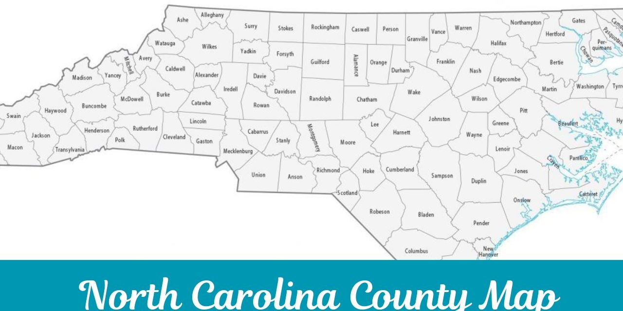
North Carolina Counties Map
Through a county map, you get to explore the geographical, legal, and political boundaries of North Carolina. The use of a map is quite diverse i.e. a student can use a map for his or her educational purpose, a tourist can use a map to find routes and different locations, a business can use a map to do market research and analysis, government can use a map to manage population, infrastructure data.
How Many Counties are there in North Carolina?
There are a total of 100 counties in North Carolina. Each county has it’s own significance and character. Every county is important for the economy growth of North Carolina. Following are some of the most known counties in North Carolina.
- Mecklenburg County
- Wake County
- Guilford County
- Buncombe County
- Dare County
- New Hanover County
The counties of North Carolina shows how diverse and dynamic this state is. There is a local governance in each county which is responsible for handing everything whether it’s law enforcement, education, public health services, etc. There are some counties which are focused on agriculture while some counties focuses on urban growth and high technology industries.
North Carolina has a diverse mix of counties which makes it one of the attractive and diversify state of North Carolina. If you are interested about the geography of each county then do check out the printable maps here.
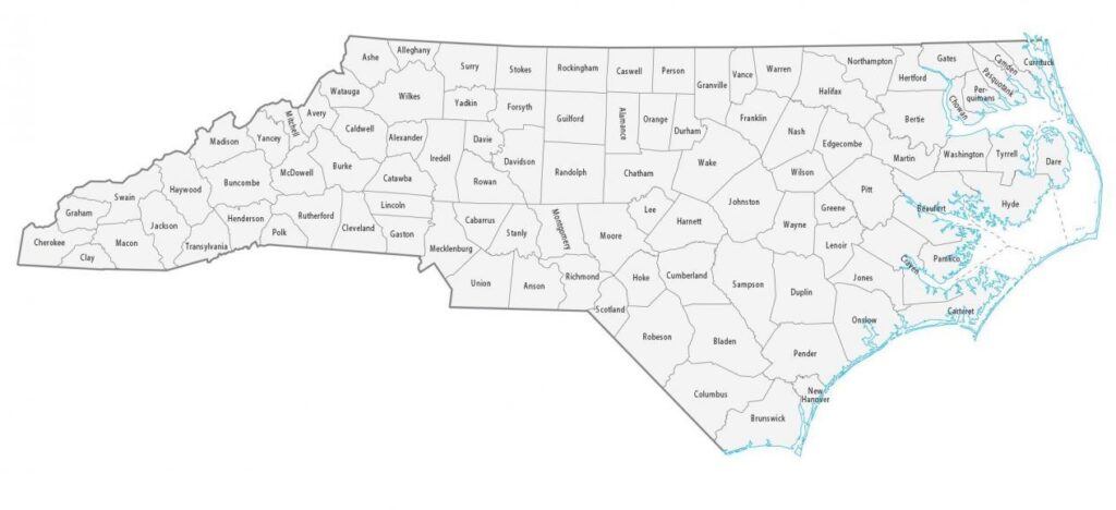
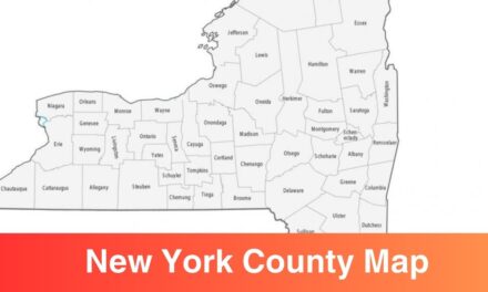
Counties in North Carolina Map
A map is one of the most valuable tool for understanding the geographic of different counties. All 100 counties are shown in a printable map below. Through this map, you get to know the name of each county, their geographical areas, their border, and neighbouring counties, etc. This type of map is crucial when it comes to navigate through the North Carolina.
North Carolina County Map with Cities
In terms of geography, you can arrange North Carolina counties in three regions i.e.
- the Coastal Plain
- the Piedmont
- the Mountains
North Carolina is one of the most diverse state where you can see almost everything i.e. beaches, farmland, lakes, big mountains, hiking trails, etc. Use North Carolina counties map to explore different counties of this state and understand the geography. Printable map templates are made available on this page, you can download any of the template in pdf and print it out for your use.
Purpose of Using North Carolina County Map
There are different purpose of using a county map and some of them are discussed below:
Learning & Education: The basic use of a county map is for learning and education purposes. Students often use a printable map to understand the geography of different cities, states, and nation. Teacher use blank map is to conduct tests and to check the knowledge of students.
Tourists: A lot of travellers rely on the printable maps to find out different routes and paths. Through maps, tourists get to know what’s the famous spots or places to travel and they plan their route or navigate through different counties using a map.
Realtors: A county map is used by realtors and potential homebuyer to check in which location a house is located, what’s the nearby landmarks, etc. Demographic trends across different counties are studied using a county map.
Government: A county map is also used by government for administrative usage. This type of map comes in handy when it comes to manage county data such as population, infrastructure, resources, etc.
Market Analysis: A lot of businesses use a county for market analysis. It helps them to understand the demographic in a county so they can strategize their products or services promotion or advertising.
