
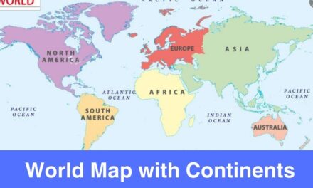
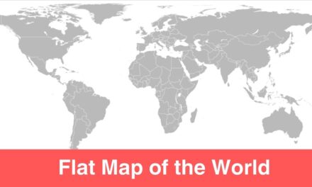
Check out the map of world here with Latitude and Longitude, you can download the world map here for free download in PDF format. A world map is of the important tools that comes in handy when it comes to study the geography of the world.
Students, teachers, and geography enthusiasts can check out the free printable world maps on this page which act as a great tool for studying the geography. There are different type of world maps available these days, each map has something different to offer, therefore, make sure to download a world map wisely depending on the type of information you require.
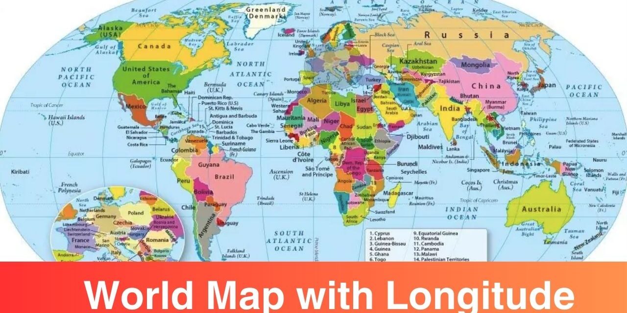
Map of the World with Latitude and Longitude

As you can see this page is loaded with number of maps available for free download. The maps on this page show how the Earth’s surface is divided. Download the Map of the World with Latitude and Longitude Lines from here.
Map of the World with Latitude and Longitude Lines
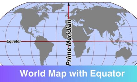
There are few terms which must be understood by every geography student i.e. Equator, Prime Meridian, Latitude, and Longitude. All these terms should be well understood, only then you will be able to understand the world maps shared on this page. All the latitudes and longitudes combined form a coordinate system or grid. This helps to determine the exact position of any location on planet Earth for navigation and other purposes.
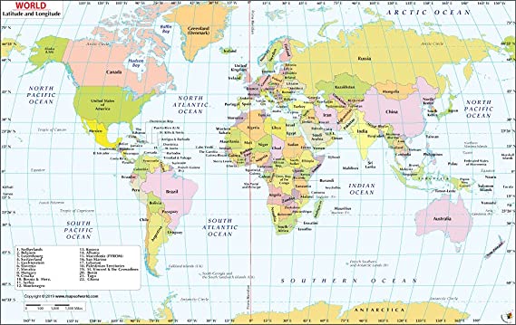
Printable Map of the World with Latitude and Longitude
What Are Latitudes and Longitudes?
People often gets confused between the latitudes and longitudes, below you can see the quick definition of them. Through the definition below, you can differentiate between the two.
Latitude: Latitude is the measurement of distance north or south of the Equator. Imaginary lines that circle the globe vertically (up and down) and converge at the North and South Poles are used to calculate longitude. These lines are known as parallels. A circle of latitude is an imaginary ring linking all points sharing a parallel.
Longitude: The term “longitude” refers to the distance east or west of the prime meridian. The North and South Poles serve as the meeting points for imaginary lines that circle the globe vertically (up and down) to determine longitude. These lines are known as meridians. Each meridian measures one arcdegree of longitude. The distance around the Earth measures 360 degrees.
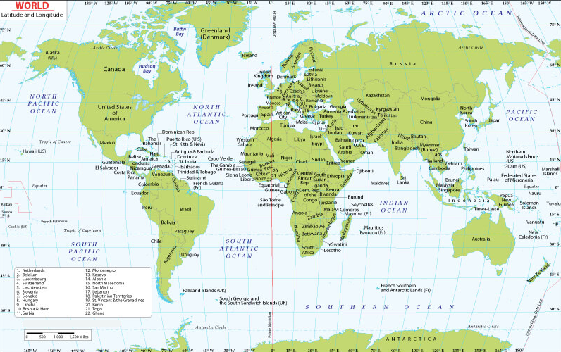
Blank World Map with Latitude and Longitude
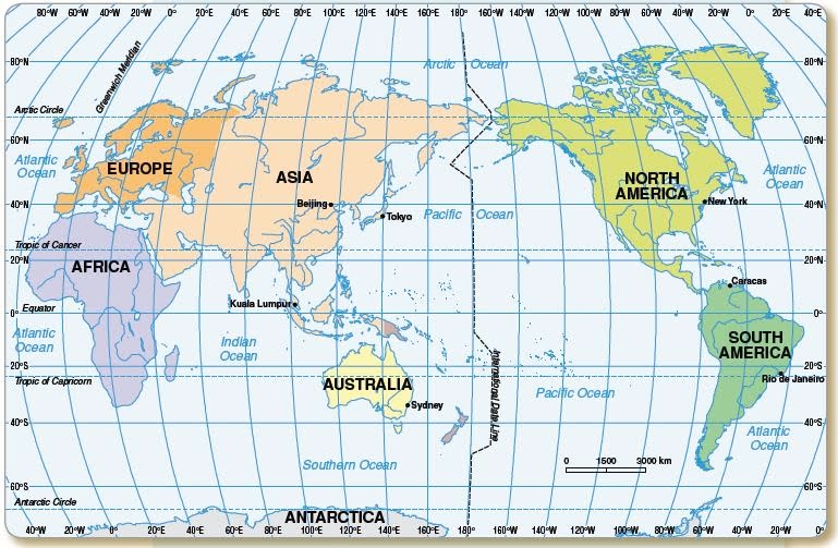
What Are Longitudes and Latitudes Used For?
It is essential to note that the Earth is divided into degrees of longitude and latitude which helps us measure location and time using a single standard. Both longitude and latitude are used to pinpoint to a specific location with the help of geographical coordinates. GPS i.e. Global Position System uses the coordinated to provide an accurate location.
Along the Equator, the lines of latitude travel east and west. They are used to specify a location’s North-South position on the earth. The longitude lines are oriented north and south. They are used to specify a location’s East-West orientation on the earth. The equator and latitude lines are parallel to them.
World Map with Latitude and Longitude
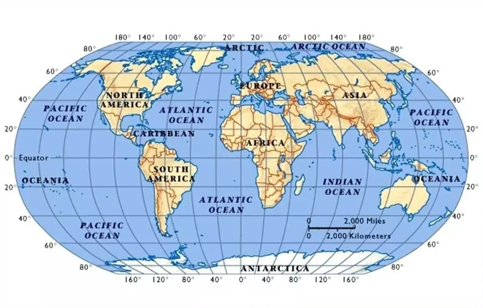
You can see the world map below that shows the lines of the Latitude and Longitude. If you are interested in studying the Latitude and Longitude lines then nothing works better that a world map. Get familiar with the Latitude and Longitude through the free printable maps shared below. You can download a map from here in PDF and take a print-out for your use.
Now you know what is a latitude and longitude. You also have enough world map templates to choose from. Feel free to download map templates from here for learning purposes. Keep checking this site for more printable maps.