
Through this post, we are covering the world map with equator and prime meridian. If both these terms are new to you then let’s begin with a quick definition. The equator is defined as the imaginary line that is drawn around the middle of the Earth. The term “equator” typically refers to a line that is traced around a sphere or planet. On the other hand, prime meridian is also the imaginary line but it is running north to south at latitude 0°. It serves as the beginning point for calculations of east-west distances around the planet.
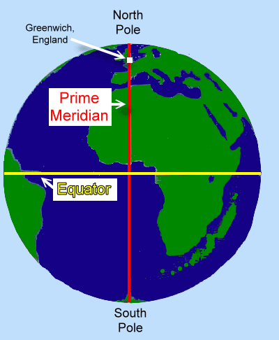
If you are still confused between the two, then please note the main difference. The line that circles the Earth midway between the North and South poles is known as the Equator, whereas the Prime Meridian is the line that passes through Greenwich, England.
Map of World with Equator and Prime Meridian
To understand the geography of the world, it is important to understand the equator and prime meridian. Keeping that into consideration, here we have shared multiple free printable world map labeled with equator and prime meridian. Download a world map from here and take a print-out for your use. It is essential to understand equator as a reference point for navigation and geography. According to the national geography, an equator divides the Earth into two equal halves at 0 degree latitude.

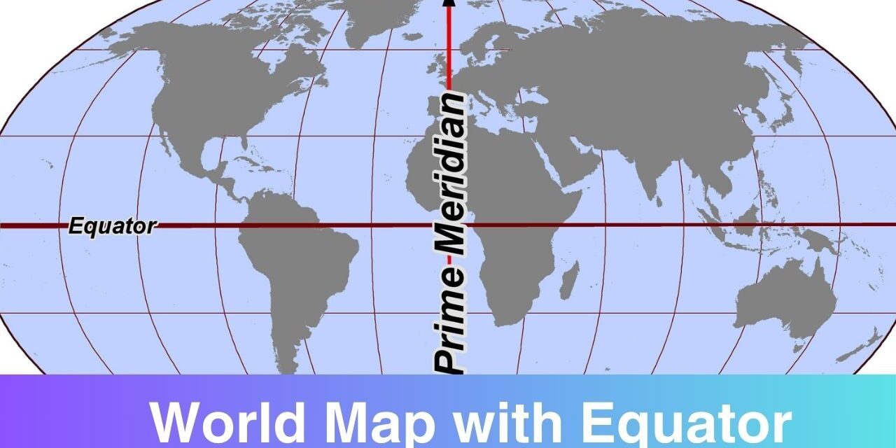
World Map with Equator
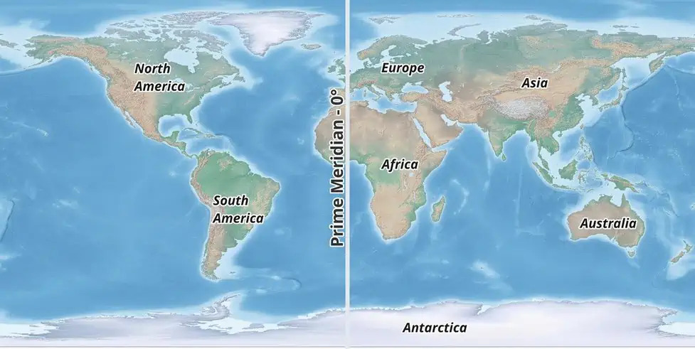
As mentioned above, an equator is the imaginary line that is drawn around the middle of the Earth. As per the information available from the world map, the Equator passes through 13 countries: Ecuador, Colombia, Gabon, Brazil, Sao Tome & Principe, Republic of the Congo, Democratic Republic of the Congo, Somalia, Maldives, Uganda, Kenya, Indonesia and Kiribati.
World Map with Prime Meridian
Both equator and prime meridian are the circles that stretches all the way around the earth. The equator, which is located at 0 degrees latitude, divides the world into its Northern and Southern hemispheres. The prime meridian can be seen as the line dividing the Western Hemisphere from the Eastern Hemisphere on the world map. The prime meridian travels across England and Greenwich at a 0° latitude angle. On this page, you can find out the map of world with equator and prime meridian to get a clear understanding of both these terms.
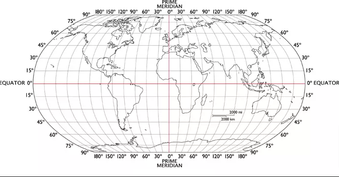
World Map with Equator and Prime Meridian
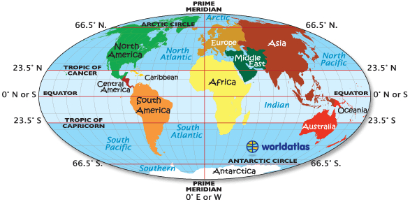
Prime Meridian is the imaginary line that divides the Earth into two equal parts i.e. Eastern Hemisphere and the Western Hemisphere. The prime meridian is used as the reference point for measuring the system called longitude. It is also used as the basis for the world’s time zones.

