
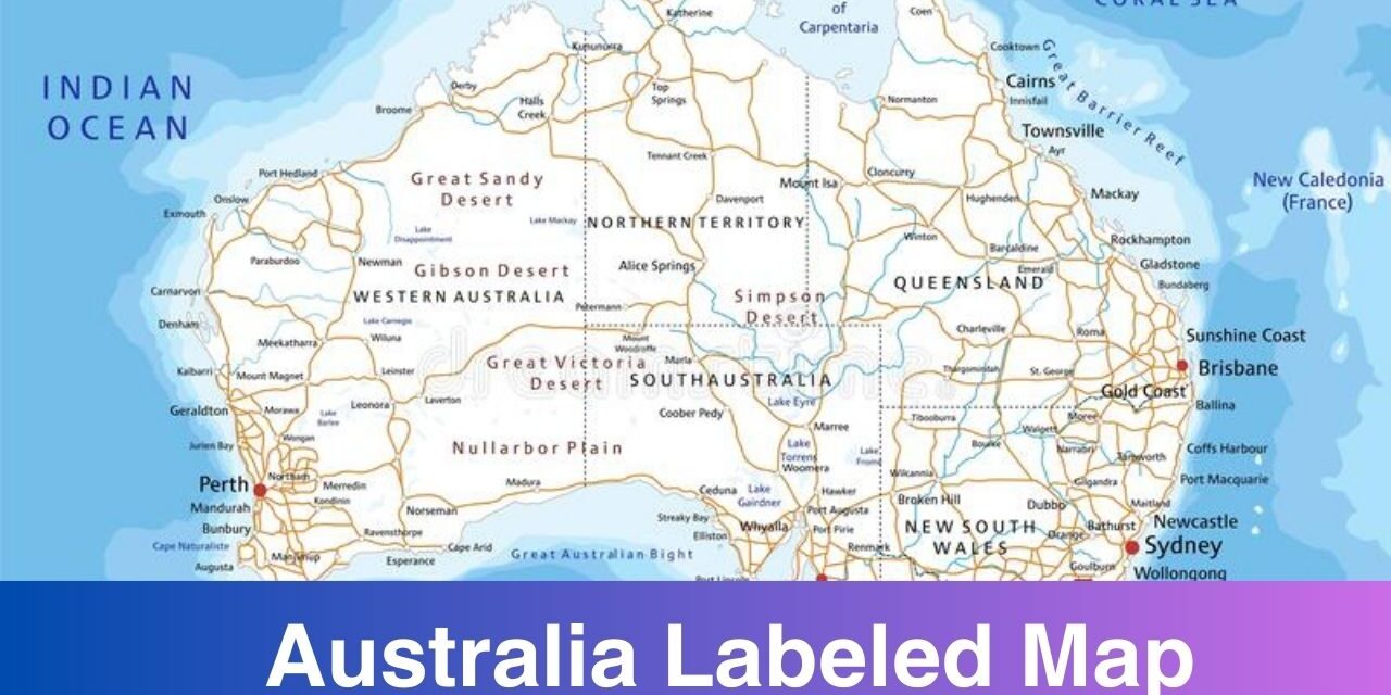
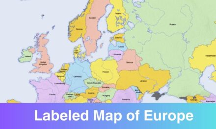
Labeled Map of Australia is shared here with states, cities, and capitals. Download and print the map of Australia from this page in JPG and PDF format. A labeled map is of the important tools that comes in handy when it comes to studying the geography. If you are a student or geography enthusiast then you must check out the labeled map on this page and download one for your own use. You can take a print-out of the map after downloading it from here.
With the help of these maps, you can get to know about the states, cities, and capitals of Australia. Different type of maps are available these days that convey the different information. On this page we have shared the map of Australia labeled with different information.
Labeled Map of Australia
Australia is the largest country by area in Oceania and the world’s sixth-largest country. Australia is the oldest, flattest, and driest inhabited continent. Australia is a highly developed country with a high-income economy. As of 2022, it was the world’s fourteenth-largest economy with the ninth-highest per capita income.

Australia is famous for tourism as well. Every year people visit this country from different parts of the country. If you are planning to make a visit to Australia then you must download a map of Australia in order to get familiar with the country and make your travel plan accordingly. Check out the printable map of Australia on this page and download it for your use in a printable format.
Labeled Map of Australia with States
The states and territories are federated administrative divisions in Australia, ruled by regional governments that constitute the second level of governance between the federal government and local governments. Download and print the Labeled Map of Australia with States and Territory from below.
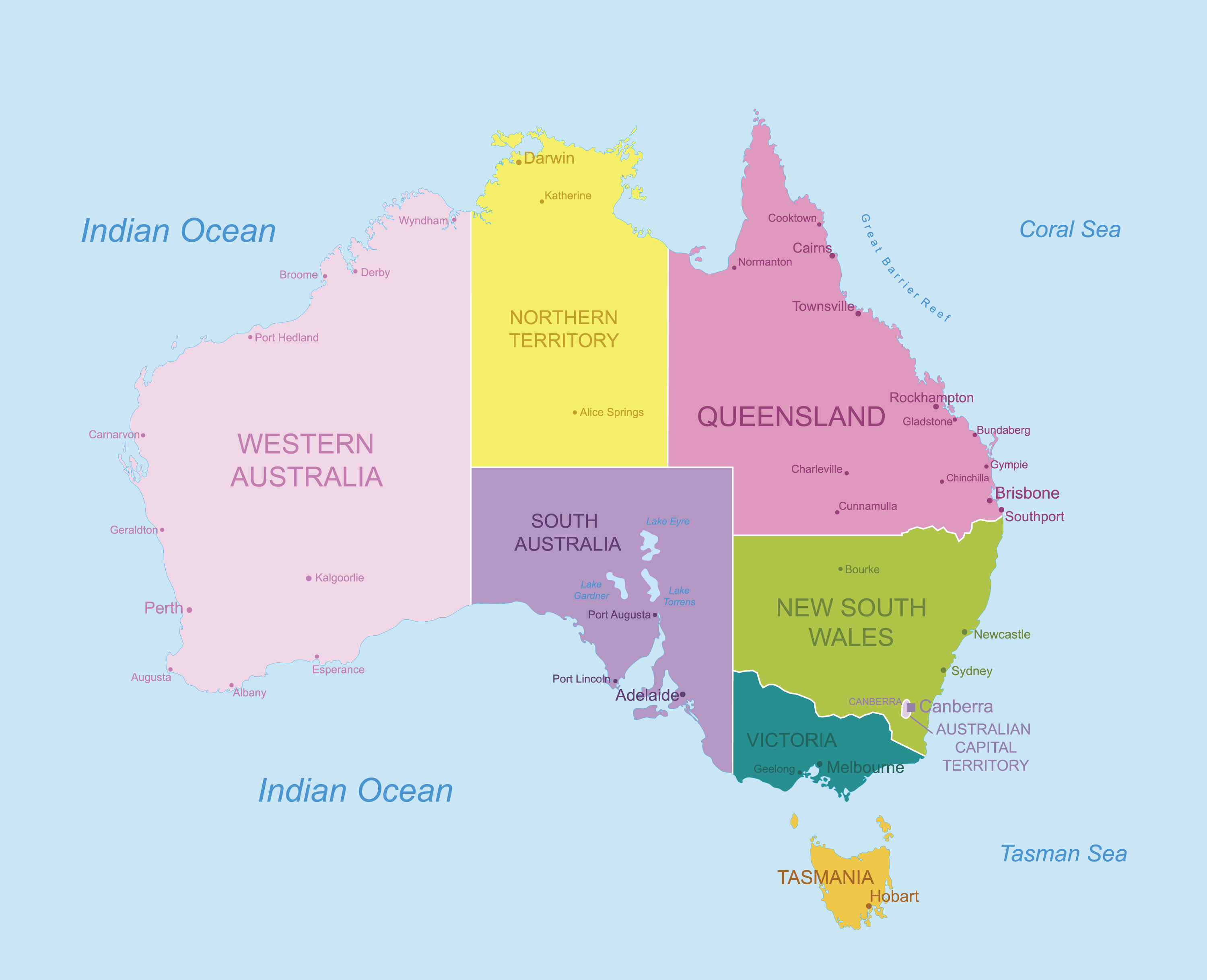
States of Australia
- New South Wales
- Victoria
- Queensland
- Western Australia
- South Australia
- Tasmania
Internal territories of Australia
- Australian Capital Territory
- Northern Territory
- Jervis Bay Territory
External territories of Australia
- Norfolk Island
- Christmas Island
- Cocos (Keeling) Islands
- Australian Antarctic Territory
- Coral Sea Islands
- Ashmore and Cartier Islands
- Heard Island and McDonald Islands
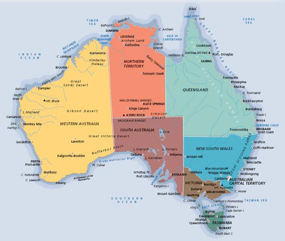
Labeled Map of Australia with Cities
There are many cities in Australia, check out the map below to get to know the names of different Australian cities. Sydney is the most populated and largest Australian city, followed by Melbourne, Brisbane, Perth, and Adelaide. Below you can see a map of Australia labeled with cities.
Labeled Map of Australia with Capitals
Mainland Australia is the world’s largest island but the smallest continent. The country is divided into six states and two territories.

Now you have different labeled map of Australia available for free download in a printable format. You can choose to download and use any of the printable map from this page. With the help of a map you get to know about the geography. Student and geography enthusiasts or researcher understand the value of a printable map and this is why here we have shared the labeled map templates.